


New Mexico Flood Watch: New Mexico is under a statewide flood watch as heavy rain and thunderstorms move across the state, with the greatest concern in areas that have already seen flooding. Moisture from the remnants of Tropical Storm Odalys is moving into New Mexico, while Hurricane Polo’s remnants could bring another round of heavy rain Tuesday, raising the risk of flash flooding, especially near burn scars, creeks, streams and other flood-prone areas.
The Brief
- A statewide flood watch is in effect across New Mexico through Tuesday night as heavy rain and thunderstorms move through the state.
- Remnants of Tropical Storm Odalys are expected to spread from western New Mexico toward Albuquerque and northern parts of the state before moving east Tuesday morning.
- Hurricane Polo could add more moisture Tuesday, with 1 to 4 inches of rain possible and another risk of flash flooding in areas already affected by flooding.
New Mexico Flood Risk
Dig deeper:
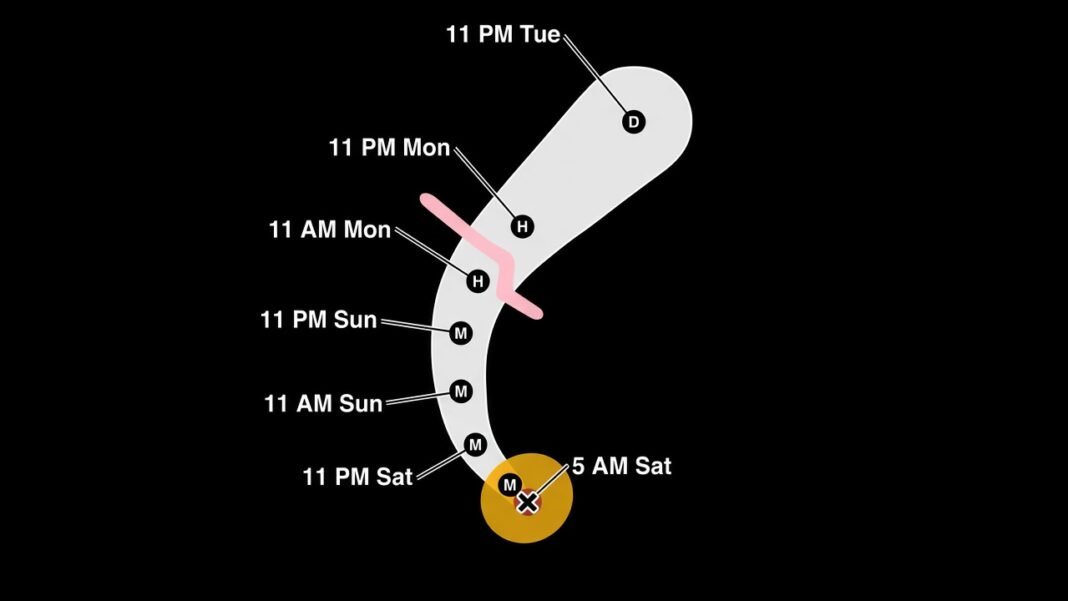
Hurricane Polo is expected to make landfall in Baja California on Monday, with its effects beginning to reach New Mexico. The hurricane is expected to track toward New Mexico, and its remnants could move directly over the state.
More: Northeast US Nor’easter Storm Brings Flooding and Power Outages
At the same time, moisture from the remnants of Tropical Storm Odalys is spreading across Arizona and moving into New Mexico. Showers and thunderstorms are expected to increase in western New Mexico, including areas from Farmington to Gallup. The storms are then expected to move through Albuquerque and northern parts of the state before leaving eastern New Mexico Tuesday morning.
Flash flooding is possible Monday evening and Tuesday morning.
The flood watch covers all of New Mexico through Tuesday night. Northern and central parts of the state, including Albuquerque and Santa Fe, could see heavy runoff. Areas along and west of the central mountains and in the Rio Grande Valley are also at risk.
Heavy rain could cause flooding in creeks, streams and other flood-prone areas. Some roads and low-water crossings could also flood.
More Heavy Rain Tuesday
The remnants of the two storms are expected to bring several days of showers and thunderstorms across New Mexico. Heavy rain could create additional problems because the ground is already saturated from recent flooding and heavy rain from last week.
On Tuesday, moisture from Hurricane Polo could bring another round of heavy rain to parts of the state. Areas that have seen flash flooding in recent days, including locations near burn scars, could face another risk of flooding.
In northeastern and east-central New Mexico, heavy rain could increase runoff in creeks, streams and low-lying areas. Some creeks and streams could reach or rise above their banks.
Rainfall totals could range from 1 to 4 inches, depending on where the heaviest rain bands develop and track.